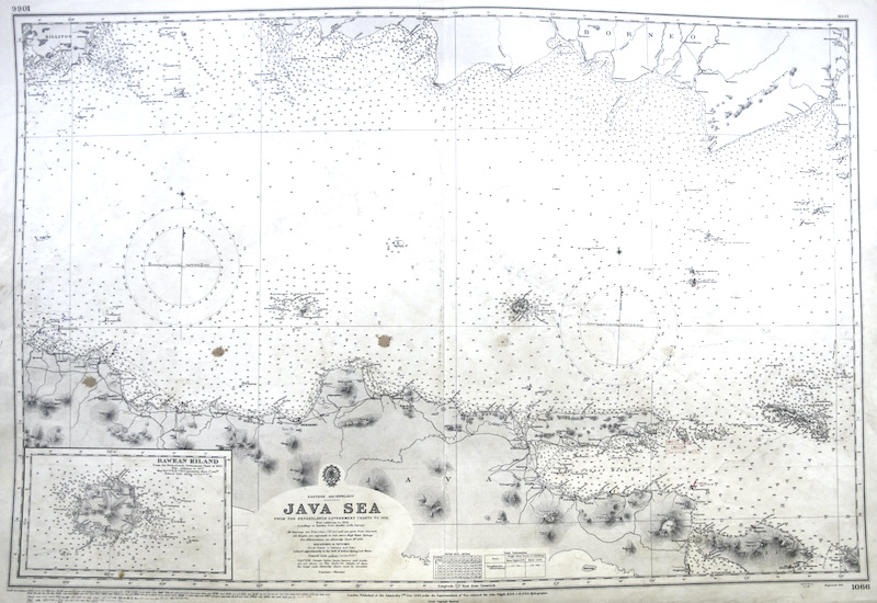
Carta náutica del Almirantazgo Británico // British Admiralty Nautical Chart.
[1066]
Se representa el territorio del archipiélago oriental del mar de Java en Indonesia (Sudeste Asiático), con inserto de "Bawean Eiland".
"From the Netherlands Government Charts to 1931 / With Additions to 1941".
"London, Published at the Admiralty, 17th Dec. 1943, under Superintendence of Vice-Admiral Sir John Edgell [...] / Crown Copyright Reserved".
"Engraved 1943".
Además, incluye un gran número correciones a tinta ("Small Corrections") realizadas durante el uso de estas cartas, hasta 1977.
|


 Contacto: 91.411.33.62 / info@frame.es")


.jpg "Taller de Enmarcación")